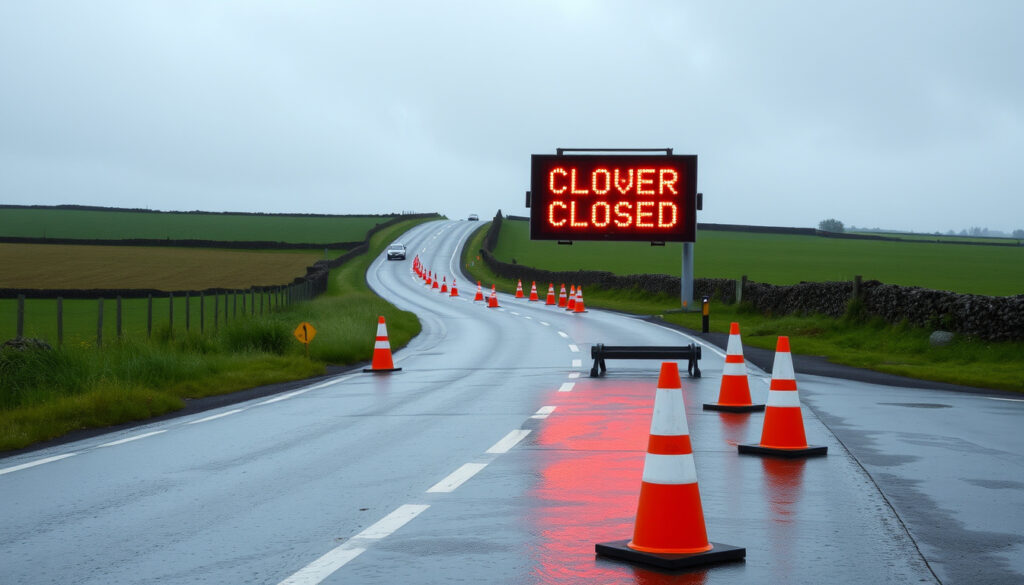
Road Closures Near Me: Live Ireland Updates Today
You’re running late, you take your usual route, and suddenly a “Road Closed” sign appears. If you’ve driven anywhere in Ireland recently, you’ve probably hit a closure. This guide pulls together the official sources—from Transport Infrastructure Ireland’s live traffic map to local council alerts—so you can find out what’s blocked, why, and how to plan around it.
Counties in Ireland: 26 · Local authorities reporting road closures: 31 · Official live traffic map: traffic.tii.ie
Quick snapshot
- TII Traffic Map provides real-time road closure information for Ireland (Transport Infrastructure Ireland (TII))
- MapAlerter offers location‑specific road alerts via SMS, email, and app (MapAlerter.ie)
- Local authorities enter closure data into MapAlerter when events occur (MapAlerter.ie)
- Emergency closures (accidents, weather) often aren’t confirmed in official systems until after the event
- Duration of unplanned closures can change with little notice
- User‑submitted or crowdsourced closure data is not consistently available in Ireland
- M2/N2 road closure due to roadworks started at 22:00 on May 13, 2026 (TII Traffic Map Events)
- A2 Warrenpoint Road dual carriageway closed 7 pm May 8 to 6 am May 11, 2026 (TrafficWatchNI)
- Planned works are typically published weeks in advance on council sites (TII Traffic Map Events)
- Check the TII live map before every journey
- Set up MapAlerter alerts for your Eircode or area
- Follow local council social media for emergency updates
Four key facts frame the national picture, one pattern: official data lives in multiple places, and knowing where to look is half the battle.
| Metric | Value |
|---|---|
| Official Source | TII Traffic Map (traffic.tii.ie) |
| Number of Counties | 26 |
| Average Closure Update Frequency | Daily for planned works |
| Main Causes | Roadworks, events, emergencies |
These four stats underline the central challenge: data is extensive but fragmented.
Ireland’s 31 local authorities each publish their own list of temporary closures. The trade‑off: you get granular detail but no single aggregated mobile‑friendly view. That’s why the TII map and MapAlerter are your best bets for a national picture.
What road closures are in Ireland today?
National overview
- Transport Infrastructure Ireland manages the TII Traffic Map, which lists both planned and real‑time events across the entire Republic (Transport Infrastructure Ireland (TII)).
- The map uses colour‑coded icons for Roadworks, Closure, and Incidents (TII help page).
- Northern Ireland has its own portal: TrafficWatchNI and NI Direct provide official closure and diversion information (TrafficWatchNI; NI Direct).
Regional closures by county
- Each of Ireland’s 26 counties has a council page listing temporary road closures, often in PDF format.
- For example, Wexford County Council issued a closure order for L7060‑2,3,4 in Kildavin from May 13 to July 22, 2026.
- South Street, New Ross (L4500‑3) was closed on May 24, 2026 (council notice).
- Check your county council website for the most localised updates (MapAlerter.ie confirms councils are primary data source).
Duration and causes of closures
- Planned roadworks can last from a few hours to several weeks—the L7060 closure spans over two months.
- Main causes: road resurfacing, utility works, public events, and emergency repairs.
- Emergency closures (weather, accidents) often lack a set end time (MapAlerter.ie lists emergency diversions as a category).
The pattern: planned closures are well‑documented with start/end dates, but emergency closures remain fluid. Checking the TII map live before heading out is the only way to catch last‑minute changes.
For a commuter in Dublin, a sudden M50 slip‑road closure means a 20‑minute detour. For a driver in Tipperary, an unplanned road closure could add 40 minutes to a rural journey. Knowing the difference between planned and emergency events determines whether you can shop for an alternative route or must wait for updates on the ground.
How can I get live traffic updates in Ireland?
Using the TII Traffic Map
- The interactive map at traffic.tii.ie shows all active events and can be filtered by region and date (TII help).
- Colour‑coded icons help you quickly spot roadworks (orange), full closures (red), and incidents (blue).
- The map is mobile‑friendly and can be saved as a bookmark on your phone.
Subscribing to council alerts
- MapAlerter sends free road alerts via SMS, email, or mobile notification (MapAlerter.ie).
- You sign up by entering your Eircode or pinpointing your location on the map (MapAlerter sign‑up).
- Alerts cover planned maintenance, resurfacing, scheduled closures, and emergency diversions (MapAlerter categories).
Mobile apps for traffic updates
- The Ireland Roads app displays current incidents, roadworks, and traffic cameras, and lets you save favourite cameras for quick access (Ireland Roads on App Store).
- Via Michelin provides live traffic conditions for the Republic of Ireland including traffic jams, accidents, and slow‑moving traffic (Via Michelin Ireland Traffic).
- Google Maps also shows real‑time closures when reported through official channels or user reports.
What this means: you have three reliable layers—the TII official map, council‑powered alerts via MapAlerter, and community‑sourced data on apps. The catch: none of these alone covers every single closure. Combining at least two sources gives the most complete picture.
How to find road closures near me?
Using your current location on traffic maps
- The TII map can be zoomed to any area in Ireland—just allow location access or type your town (TII map help).
- TrafficWatchNI works similarly for Northern Ireland (TrafficWatchNI).
- Google Maps “traffic layer” can be toggled on; closure icons appear when data is available (Via Michelin also provides live layer data).
Checking local council websites
- County council pages list closures by road number. For instance, Wexford County Council publishes a PDF of temporary road closure orders.
- Search “[County name] temporary road closures” to find the dedicated page.
- Many councils also use social media for urgent updates.
Setting up geotargeted alerts
- MapAlerter’s Eircode‑based sign‑up ensures you only get alerts for your area (MapAlerter.ie).
- You can set alerts for multiple locations (e.g., home and workplace).
- NI Direct offers email alerts for road closures in specific postcodes (NI Direct).
The implication: getting localised closure info is straightforward once you know the right tools. For a driver in Dublin, the TII map is fastest. For someone in rural Clare, council alerts may catch closures that don’t appear on the national map.
Emergency closures—such as those caused by flash flooding or serious accidents—are not immediately captured by council systems. Gardaí often manage these on the ground before data reaches any map. If it’s an urgent situation, rely on local radio or social media over digital maps.
Timeline signal
- May 8–11, 2026: A2 Warrenpoint Road dual carriageway (Newry bound) closed continuously from 7 pm Friday to 6 am Monday (TrafficWatchNI).
- May 13, 2026: M2/N2 road closure due to roadworks started at 22:00 between R135 Ashbourne (North) and end of M2/N2 near Dublin (TII Traffic Map Events).
- Ongoing (May 13 – July 22, 2026): L7060‑2,3,4 in Kildavin, Co. Wexford closed for roadworks (TII Events list).
- May 24, 2026: South Street, New Ross (L4500‑3) temporary closure.
- Starting May 27, 2026 at 22:00: M50(N) Off‑Slip at J6 closed for roadworks.
This sequence shows the mix of long‑term planned closures (Kildavin), weekend‑long works (A2), and overnight slip‑road maintenance (M50). The common thread: advance notice is the norm for these events.
Clarity section
Confirmed facts
- Planned closures with published start/end dates on TII Traffic Map and council sites
- MapAlerter – a verified alert system used by local authorities
- Official Northern Ireland closures on TrafficWatchNI and NI Direct
- Ireland Roads app and Via Michelin as secondary real‑time sources
What’s unclear
- Duration of emergency closures (weather, accident) not yet confirmed in official systems
- Some council PDFs may not be updated in real time
- User‑reported closures on social media may lack official verification
- How long a road will remain closed after an accident is rarely announced
Quotes
“Temporary road closure order for L7060‑2,3,4 in Kildavin, Co. Wexford from May 13 to July 22, 2026.”— Wexford County Council notice (via TII Events)
“M50(N) Off‑Slip at J6 — road closure due to roadworks starting at 22:00 on May 27, 2026.”— Transport Infrastructure Ireland event list
These official notices represent the kind of lead time you can expect for planned works. For emergency closures, such precise statements are rare.
Summary
Navigating Ireland’s road closures comes down to using the right combination of official tools: the TII live map, MapAlerter alerts for your Eircode, and your county council’s closure page. Planned works are well‑documented, but emergency closures can appear with little warning. For the driver in rural Tipperary, the choice is clear: set up MapAlerter today and check the TII map before every trip, or risk a 40‑minute detour that could have been avoided.
For drivers in the UK, similar live road closure maps are available through National Highways and local council alerts.
Frequently asked questions
How long do road closures in Ireland typically last?
Planned closures can last from a few hours to several months, depending on the scope of works. Emergency closures (accidents, weather) last until the scene is cleared, which can range from 30 minutes to many hours.
Are road closures announced in advance?
Yes, planned closures are usually published weeks ahead on council websites and the TII Traffic Map. Emergency closures are announced as they occur via social media, local radio, and sometimes MapAlerter.
How can I report a road closure?
Report a closure to your local authority or Gardaí. Many councils have an online reporting form. You can also notify MapAlerter if you are a registered user.
Does Google Maps show road closures in Ireland?
Yes, Google Maps can display road closures when data is provided by official sources or reported by users. However, it may not be as up‑to‑date as the TII map for planned closures.
What is the difference between a road closure and a roadwork?
A road closure means the road is completely blocked to traffic. Roadworks often involve lane restrictions or temporary traffic lights but may not close the road entirely. Both appear on the TII map.
Can I get alerts for road closures near my home?
Yes. Sign up for MapAlerter using your Eircode to receive SMS, email, or app notifications for closures in your area. NI Direct offers similar alerts for Northern Ireland.
What should I do if my route is closed?
Check the TII map or your council site for diversion routes. If it’s an emergency closure, follow local diversions set by Gardaí. Consider using the Ireland Roads app to find an alternative path.
More related posts
 Real Madrid vs Marseille – Champions League Preview
 Us Planes to Middle East – B-52 Bombers Fighters Tankers Deploy
 20 cm in Inches: Exact 7.874″ Conversion + Ruler Guide
 Now You See Me – Plot Cast Ending and Sequel Status
 Best Thermoses for Coffee – Top Lab-Tested Picks 2025
 Lauren Patel: Nationality, Age, Height, Movies, TV Shows & More
 Coffee Shops Near Me: Dublin’s Best Cafés by Neighborhood
 What’s On in London: Best Shows, Exhibitions & Events